

Open User Map
Empower your visitors to add and manage locations on an interactive map with no coding or API keys required.
tool Details
Explore More
Alternatives
About Open User Map
Open User Map is the ultimate interactive maps plugin for WordPress that transforms your website into a dynamic, community-driven mapping experience! This powerful tool lets you create a map that your visitors can actively contribute to with frontend submissions, approval workflows, and incredibly powerful customization options. The best part? You can do all of this with absolutely no coding required, no Google Maps API key needed, and no complex setup processes to worry about. Open User Map is perfect for businesses, organizations, community groups, tourism boards, event planners, and anyone who wants to build an engaging, user-powered map that grows and improves over time. With over 15,000 active installs and a perfect 100% five-star rating, it is the number two map plugin on WordPress.org for very good reason. This plugin empowers your audience to add and edit locations directly on your map, while you maintain complete control through a simple approval workflow. Whether you need a simple location directory, a complex interactive campus guide, or a community-driven resource map, Open User Map delivers professional results without the technical headaches. You get powerful customization with custom fields, marker categories, lines and areas, and even custom image maps. Plus, you can start with a fully functional free version or unlock everything with a no-risk seven-day PRO trial that requires no credit card and automatically ends without turning into a paid subscription. Open User Map makes interactive mapping accessible, fun, and incredibly effective for any WordPress website!
Features
Frontend Location Submissions and Editing
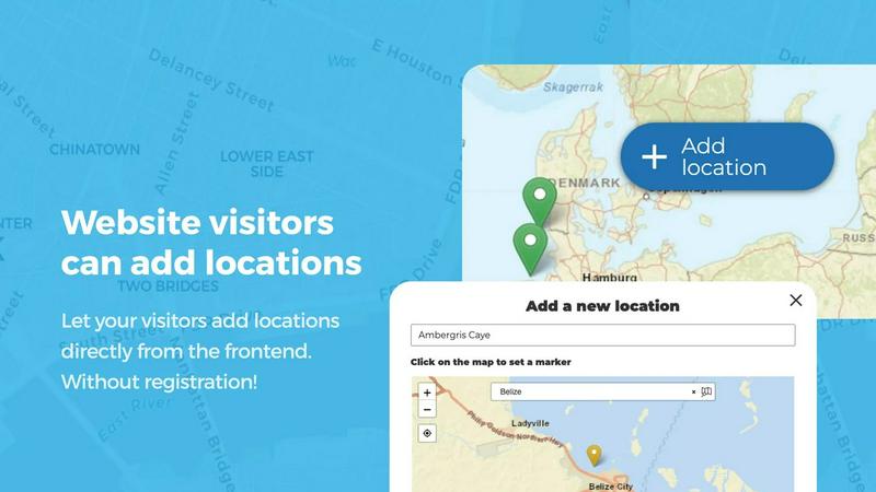
Empower your website visitors to add and edit locations directly on your map with just a few clicks! When users click the Add location button, they can easily place a marker and submit all the relevant details. But you stay in complete control because every submission goes through your approval workflow before it goes live. The editing capability is equally powerful, allowing users to update their existing locations whenever information changes. This means your map always reflects the most current and accurate information without you having to do all the work yourself. It is the perfect way to build a community-driven resource that stays fresh and relevant!
Marker Categories and Advanced Filtering
Organize your map like a pro by grouping locations into marker categories, each with its own unique and distinctive icon! This feature instantly clarifies your map layout and makes it visually appealing and easy to navigate. Visitors can filter through different types of locations to find exactly what they need without any confusion. For maximum flexibility, each location can belong to multiple categories, ensuring that all relevant attributes are represented and easily discoverable. Whether you are mapping restaurants, hiking trails, historical sites, or service providers, categories and filtering make your map incredibly user-friendly and engaging!
Lines and Areas Mapping
Go way beyond simple location markers by adding routes, paths, zones, and regions directly to your map! The Lines and Areas feature lets you highlight hiking trails, service coverage areas, event grounds, neighborhoods, construction zones, or any custom shape that helps visitors understand your map at a single glance. Distances and area sizes are calculated automatically, so routes and polygons include helpful measurements right out of the box. This is absolutely perfect for showing bike paths, delivery zones, park boundaries, or any geographic feature that needs more than just a point on a map. Check out the demo to see it in action!
Custom Image as Map
Upload any image and transform it into a fully interactive map with this incredible feature! Whether you need an overlay, floor plan, event layout, game map, product diagram, campus guide, or seating chart, you can allow users to place markers directly on top of it with the same powerful functionality as a traditional map. Add locations, display custom fields, enable filtering, and create an engaging, clickable experience tailored exactly to your specific use case. This opens up endless creative possibilities for indoor mapping, event planning, educational resources, and so much more. Check out the demo to see the amazing possibilities!
Use Cases
Community Tourism and Travel Guide
Create an incredible community-driven travel guide where locals and visitors can add their favorite restaurants, hidden gems, scenic viewpoints, and must-visit attractions! Visitors submit locations with photos, descriptions, and categories, while you approve everything to maintain quality. Add star ratings and upvotes so the best places naturally rise to the top. This builds an authentic, ever-growing resource that showcases your area perfectly!
Interactive Event and Festival Map
Build a stunning interactive map for your festival, conference, or community event that attendees can actually contribute to! Use the custom image map feature to upload your event layout or floor plan, then let vendors, exhibitors, and attendees place their own markers. Include custom fields for booth numbers, schedules, and special offers. Add lines and areas to highlight stages, entrances, and restricted zones. This creates an engaging, up-to-date event guide everyone loves!
Local Business and Service Directory
Launch a powerful local business directory map where business owners can add and update their own listings! Use categories for different business types like restaurants, shops, services, and healthcare. Enable opening hours with the live Open Now indicator so visitors instantly know which businesses are currently open. Include custom fields for contact info, websites, and special offers. The upvote and star rating features help highlight the best local businesses automatically!
Campus and Facility Navigation Guide
Design an easy-to-use navigation map for university campuses, corporate headquarters, hospitals, or large parks! Use the custom image map feature to upload actual campus maps or floor plans. Add markers for buildings, departments, parking lots, restrooms, and key facilities. Use lines and areas to show walking paths, shuttle routes, and restricted zones. Visitors can search and filter to find exactly what they need, making navigation simple and stress-free for everyone!
Frequently Asked Questions
Do I need a Google Maps API key to use Open User Map?
Absolutely not! That is one of the best parts about Open User Map. You do not need any Google Maps API key, no coding skills, and no complex setup. The plugin works right out of the box with OpenStreetMap, so you can start building your interactive map immediately without any technical hurdles or additional costs. Just install, activate, and you are ready to go!
Can I try all the PRO features before buying?
Yes, you can! Open User Map offers a fantastic 7-day free trial of the PRO version that unlocks every single feature. The best part is that no credit card is required to start your trial, and there is absolutely no commitment. The trial automatically ends after 7 days and does not turn into a paid subscription. This gives you plenty of time to test everything and see if PRO is right for you!
How do location submissions and approvals work?
Your website visitors can click an Add location button on your map to place a marker and submit details like name, description, photos, and custom fields. All submissions go into a pending queue that you can review in your WordPress admin. You have full control to approve, edit, or reject each submission before it appears on your public map. This ensures quality content while still allowing your community to contribute easily!
Can I customize the look and feel of my map?
Absolutely! Open User Map offers powerful customization options to make your map match your brand perfectly. You can create custom marker categories with unique icons, add custom fields like text boxes and dropdowns, and even upload a custom image to use as your map background. The advanced filter interface lets you create a sidebar for easy navigation, and you can add custom HTML content sections for additional branding and information!
Similar to Open User Map

Built2WinWeb AI Strength Scanner
AI‑ready websites, WebAgentScan SaaS, and Indexing Pack. MCP, A2A, llms.txt — hand‑coded PHP, complete ownership, flat‑fee, free quote.
Unifyca
Unifyca gives you total control and clarity by unifying your agency's WordPress site management, audits, and backups into one seamless platform.
Shadcn Examples
Unlock your web app potential with stunning React and Tailwind UI kits featuring reusable examples and blocks for every project need!.
Webleadr
Webleadr lets you effortlessly find and contact businesses without websites, turning leads into clients in just a few clicks!.
SiteMd
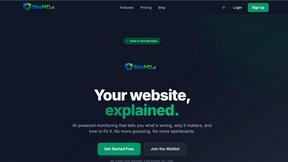
SiteMd rapidly scans your website for issues, providing clear reports and actionable fixes to boost performance and enhance SEO!.

Idearium
Idearium crafts unforgettable websites that boost your online presence and drive measurable business growth!.

FilexHost
Effortlessly host and share any file in seconds with FilexHost's simple drag-and-drop interface and instant links!.

Crawlkit
Crawlkit instantly transforms any website into structured data and screenshots with just one powerful API call!.